
Midnight
Schooner-Barge · United States · Lost 1889 · Saginaw Bay & the Michigan Thumb
A schooner-barge driven ashore with the Mears near Au Sable Point in a fierce 1889 snowstorm, remembered for the Life-Saving Service rescue that followed.
Become Captain of RecordSee Shipwreck on Map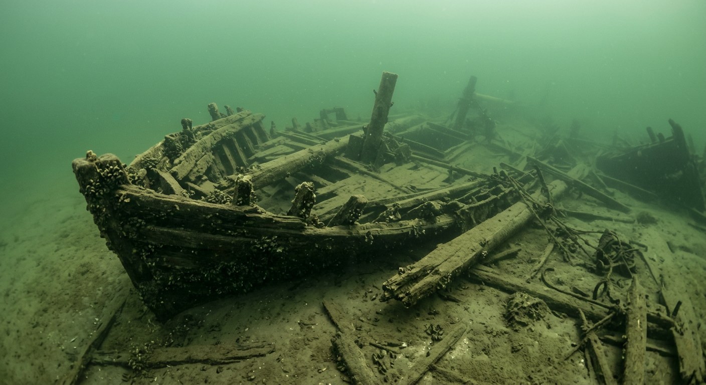
The Vessel and Her Loss
Vessel
- Not established
- Not established
- Not established
- Wood
- Not established
- Not established
- Not established
- Sail (towed)
- Not established
Loss
- November 27, 1889
- Storm
- Near Au Sable Point (then Fishing Point), Saginaw Bay
- Lake Huron
- Ottawa Bay (now Tawas Bay), Michigan
- Not established
- Not established
- Not established
- Not established
The Wreck Today
- Not established
- Broken and scattered; remains lie near the wreck of the Mears and the two are difficult to distinguish.
- Not established
- Not established
- Not established
Position
- 44.33° N 83.34° W
- General area only
- Au Sable Point, Oscoda, Michigan
General area only: coordinate of Au Sable Point from the USGS Geographic Names Information System, marking the named place near the loss location recorded for this vessel, not a surveyed wreck position.
Evidence
Overall confidence: Partially documented (55/100)
The vessel's build year, dimensions, and precise loss-of-life figures are not established in the sources reviewed.
Midland Daily News (Ric Mixter/Ralph Roberts Collection retrospective)
Storm date, tow arrangement, rescue narrative.
Great Lakes Shipwrecks and True Tales (lakeboats.blogspot.com)
Wreck site description and location detail.
USGS Geographic Names Information System — Au Sable Point, Michigan
coordinate of the named place near the loss location























































